This article sends you a measurement test using a drone equipped with a magnetometer unit that we have developed and how it came about.
We are completely new to the development and implementation of airborne magnetic surveys on our own.
We have had several experiences of magnetic surveys in Japan and abroad, but we have relied on other companies to carry out the measurements.
We received the final results in the form of drawings called magnetic anomaly maps, on the basis of which we estimated the underground structure.
We have never thought about ensuring the quality of the data (raw data) in the actual measurement, what is the quality of the magnetic measurement data, what measurement conditions are necessary in the first place, and how to ensure the quality of the data.
We had never thought about the following questions.
What is mean by data quality?
What are the items to be tested
How do we ensure test fields?
We will be informing about the process we followed to address these issues.
The most useful reference for us in this process is the following document in Japan, published by the Geophysical Exploration Society of Japan.
The report is titled: ‘Study on airborne electromagnetic survey and airborne magnetic survey methods for geothermal resource survey in 2016’ (download URL could not be found).
And the research results of Mr Nakatsuka and Mr Okuma, published by the Geology Centre of the National Institute of Advanced Industrial Science and Technology.
https://www.gsj.jp/researches/openfile/openfile2018/openfile0655.html
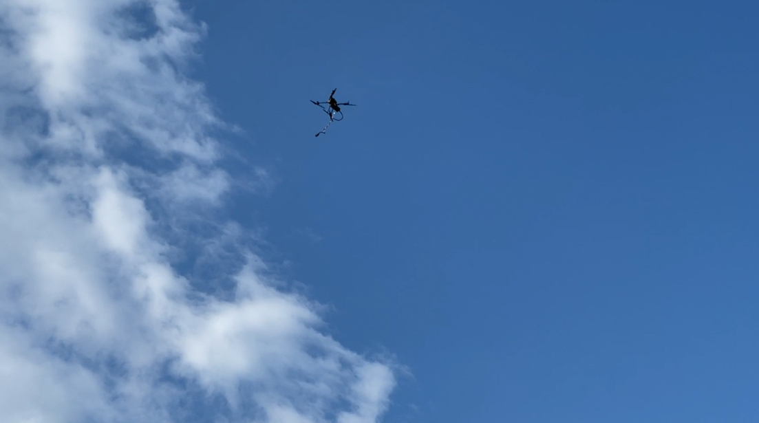
As a result, we suffered from the pendulum movement of the measuring unit.
There were no problems in manual operation, but it was not easy to create them in the flight plograms.
Basically, airborne magnetic surveying is an out-of-sight navigation, so it is essential to be able to create a suitable flight programme.
We will send you a particularly detailed account of how this happened.