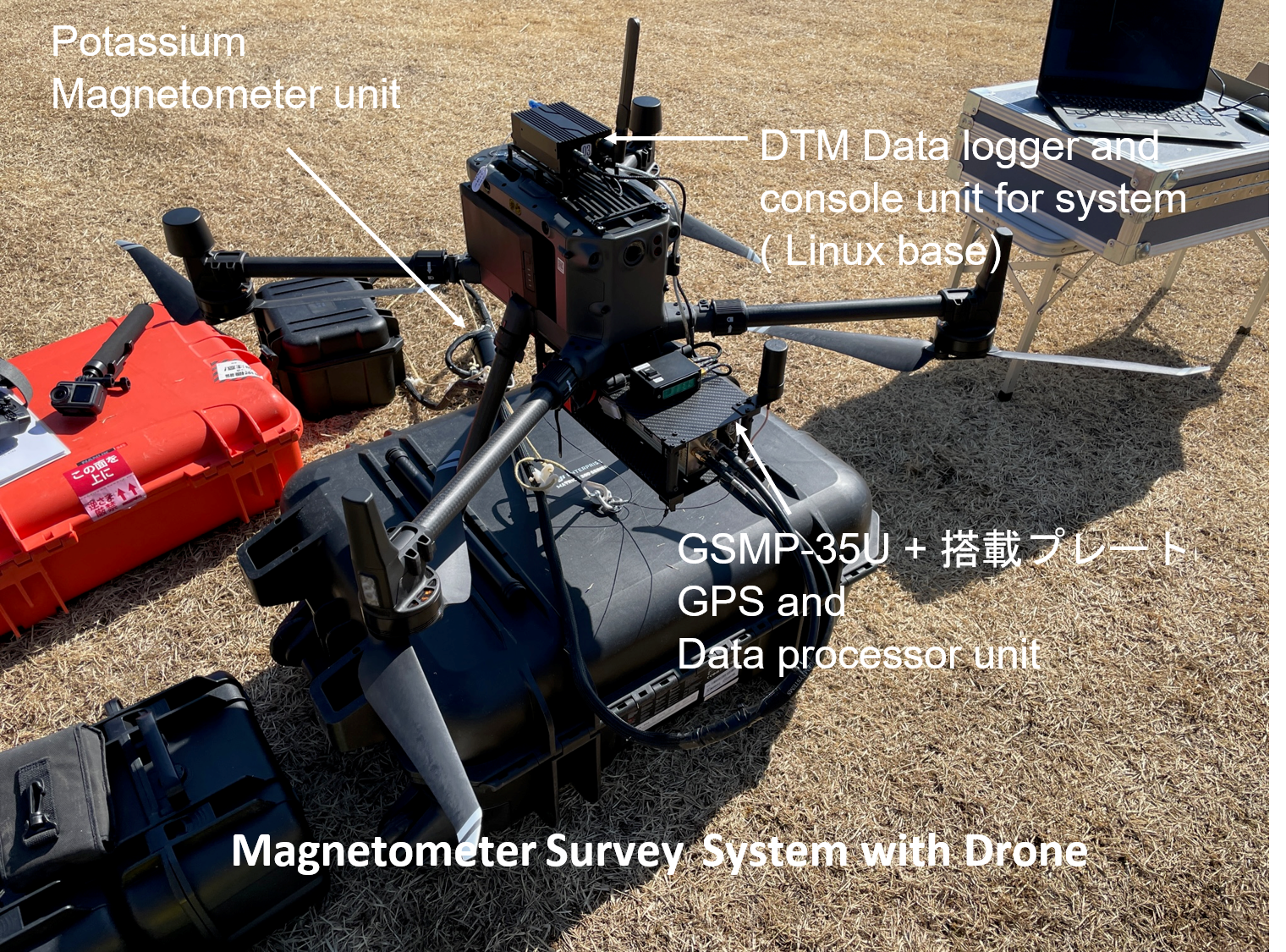
In cooperation with Tierra-Technica Ltd, a manufacturer of geomagnetic measuring instruments, we have developed a drone equipped with a potassium total magnetometer manufactured by GEM of Canada. Field tests have been completed with the support of Akaiwa City and the Earth History Research Institute, and the drone is now available to everyone as an aeromagnetic survey service.
Although it depends on the required specifications and local terrain and weather conditions, it is possible to measure a line distance of approximately 25-50 km/day at a line spacing of 50 m and a flight altitude of 50 m (ground-to-ground height) (in Japanease mountainous areas).
In the future, the system aims to be able to measure an average of 50-60 km/day.
Various corrections to measurements, data acquisition for corrections and analysis such as the creation of magnetic anomaly maps are also possible, but currently only measurement services are available due to the trial period.
For more information on the development of the technology, please refer to the case studies and technical developments.
Tierra-Technica Ltd,
Akaiwa City
https://www.city.akaiwa.lg.jp/index.html
Earth History Research Institute