We provide laser surveying and photogrammetry services with Lidar using the DJI products.
Our team consists of field engineers whose main fields of work are economic geology, civil geology, remote sensing and gravity surveying.
We can discuss your project from a field engineer’s point of view and determine the required accuracy and specifications.
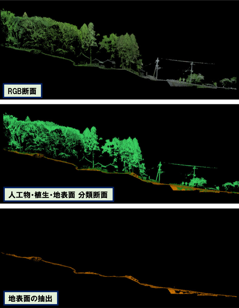
High-resolution topographic contor maps and orthoimages image for Geological Lineament Assessment in active fault surveys.
The following are some examples of landslide topography in a specific area.
The system can also be used to determine the location of archaeological sites in a particular area (20 square kilometres).
We provide high-resolution topographic map of a specific area (20 square kilometres) for a geological survey quickly.
We are always ready to respond to requests such as these.
We also use these technologies for our own exploration activities as required.
。